The Need For Accuracy
There is more to calculating accurate distances than simply measuring between points on a shore line map of the world. AtoBviaC is the only company which offers routes actually calculated by Master Mariners and Marine Navigators using up-to-date hydrographic charts of the world. Realistic distances are essential for the correct and consistent evaluation and performance of voyages in all sectors of the shipping industry.
The shortest way between two points is not a straight line
Calculating a Freight Rate Differential for a 2 Port Discharge
When calculating a freight rate differential for a 2 port discharge it is important to use the correct distance. The following example calculates the element of the differential which is dependent on the distance between the ports in question.
An example
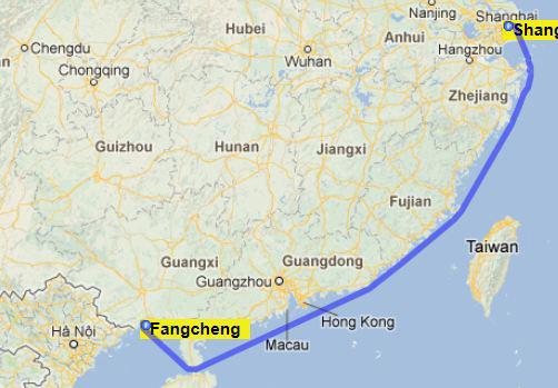
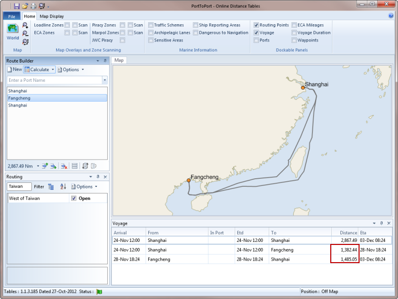
Using a simple computer algorithm with a shore line map of the world to calculate the distance between Shanghai and Fangcheng would give a figure of 1,185 miles. The actual distance is in fact 1,382 miles as the vessel must respect traffic separation schemes, navigational hazards and oil fields.
If the daily hire of a Capesize vessel, steaming at 14.5 knots and burning 62 tonnes per day is US$ 20,000 and the price of fuel is US$ 600 per ton then the cost of this voyage leg using a distance of 1,185 miles is as follows :-
1,185 / (14.5 x 24) days x (20,000 + (62 x 600)) := US$ 194,775
Whereas the real cost using the correct distance of 1,382 miles is :-
1,382 / (14.5 x 24) days x (20,000 + (62 x 600)) := US$ 227,156
On a total cargo size of say 150,000 mt the difference in costs of the voyage leg element in the differential amounts to 22 cents. This may not seem that significant, but these calculations do generate much debate and it is important to get them right.
Many vessels would not route West of Taiwan, in which case the distance to use would be 1,485 miles. In this case the differential would be 32 cents.
When daily rates are much higher, then these differential figures become far more significant.
These kinds of calculations are always being made. Even when the ports in question are relatively close, the distance is never what it may first seem. The route between ports is always determined by local features both natural and man-made which invariably impact on the economic aspects of the voyage, and must be taken into account.
Conclusion
A direct line distance between 2 ports is rarely the correct one. Prior to a voyage, when negotiating a charter with multi-port differentials, if both parties to a negotiation use the AtoBviaC distance then management time will not be wasted by needless discussion regarding the distance between 2 ports. A quick, logical and fair conclusion will result.
Shortest route or reduced environmental impact route?
The Distance Tables provide the ability to avoid particularly environmentally sensitive areas where a viable alternative route exists.
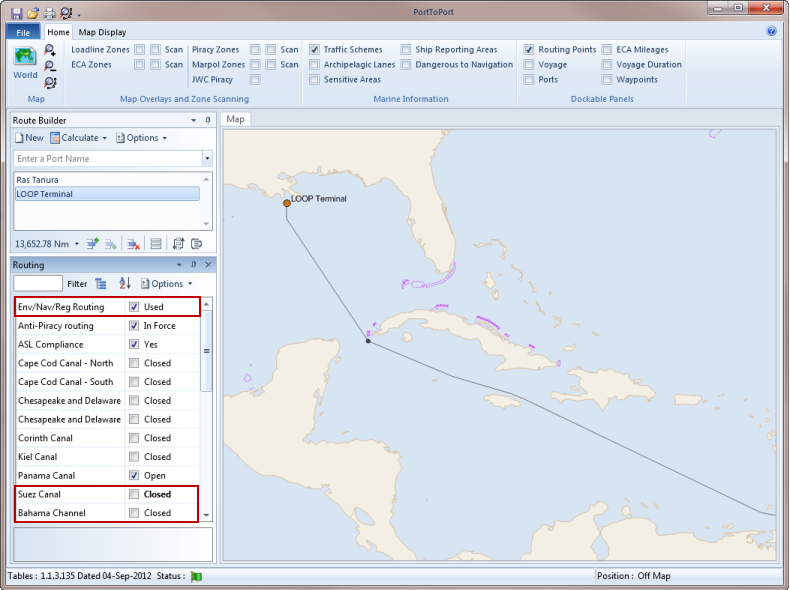
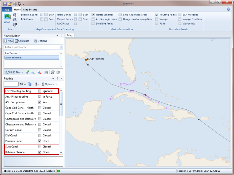
The shortest route would take the vessel through the Caribbean and up the Bahama Channel between Cuba and the Bahama Banks. The tables will still route through the Caribbean; however, the route will pass to the West of Cuba to avoid this environmentally sensitive area.
ECA Distances
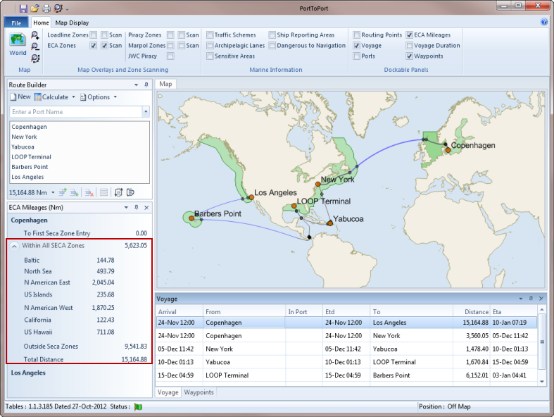
Whilst the voyage illustrated might be somewhat contrived, it does illustrate passage through each of the current ECAs with the display of the distance within each area and the distance outside any area. Whether or not a vessel will minimise its passage through any of these areas is dependent upon a variety of factors, including but not limited to the vessel, its method of propulsion, exhaust gas filtering systems, the cost differential of different types of fuel etc. Our software applications do not attempt to adjust the route used to minimise distances within (S)ECAs but do offer the ability to determine the mileage steamed within those areas and thereby give the user the opportunity to consider the impact on the voyage.